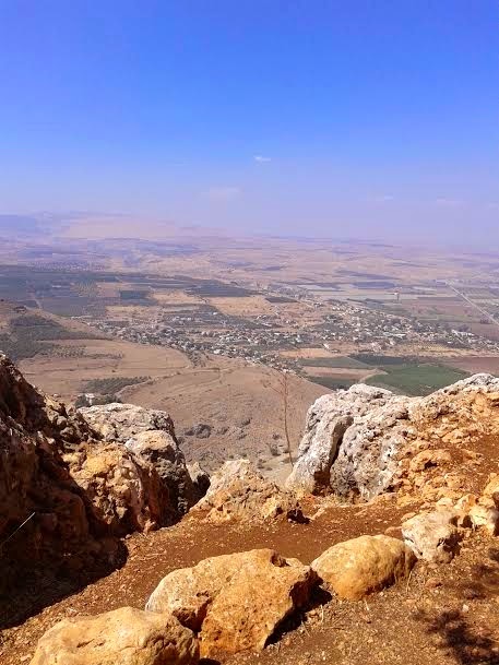
A couple visiting from Houston who stayed next door to us in the kibbutz suggested we visit Mt. Arbel. In turn we sent them to our swimming area at the Sea of Galilee! There are four villages around this area and Mt. Arbel itself appears higher than it actually is. The peak, at 181 metres above sea level (380 metres above the surrounding area), dominates the surroundings (much of the area is below sea level) and from the lookout atop the mountain, almost all of the Galilee into the Golan Heights including Safed, Tiberias and most of the Sea of Galilee, is visible. The area was declared a nature reserve in 1967 and the declaration covers the immediate areas around the cliff as well as the mountain itself. Nearby are the ruins of an ancient Jewish settlement with a Synagogue from the fourth century C.E. with extend pews and columns, and dug into the mountain itself are a number of cliff dwellings. The extant cliff dwellings are from the 17th century and were built by the
A display at peak is a replica of the wooden basket used to haul workers
and supplies up the cliff before there was access by road. As well the
site is prominently featured in the Bible. The battle described in
Hosea is between Assyrians and Israelites, though the blood
didn’t stop flowing with the Assyrians; The historian Josephus
who describes the mountain as being captured with massive executions.
In 39 B.C.E. came Herod the Great dropped his soldiers
down in baskets for closer proximity in their mission of
slaughtering the Jews hiding in caves in the face of the mountain.
Some associate the Biblical reference to “land of the shadow of death”
as a reference to the shadow cast by Mt. Arbel.
 |
View of small Arab village from the top of the cliff |
 |
Danny on the edge with his camera |
 |
Another village in the distance |
Me grabbing the rail at a lookout so as not to be blown away.
 |
Reconstruction of a home in Safed, another town we visited |


No comments:
Post a Comment